We have hit up against a block. In the three or so miles covered since setting out from Golders Green we have passed through several clear and distinct zones.
First, we followed our water main down through suburban streets dating from the 1920s and 30s before crossing the busy A41(T) into more of the same. Next, after crossing the St. Pancras railway we have walked through an area featuring houses older than those north of the railway. We have visited a Victorian pumping house and cut diagonally across a park intersected by a railway line. For a while we walked through a residential area coloured by the Hindu temple on Conduit Road and overshadowed by the arch of Wembley. During this phase we were accompanied by the hum of the great arterial just over yonder, moving parallel with this. While willing to show interest in all this phantasmagoria we continued to bear in mind our primary purpose: These streets and parks were all just passing stages on our way; silly townships, snarling zip-cars and outposts of religion and sport. What has concerned us is something far deeper. For we have been tracing the residue of a race of giants, the trace of a great civilisation now passed. We have been following The Way.
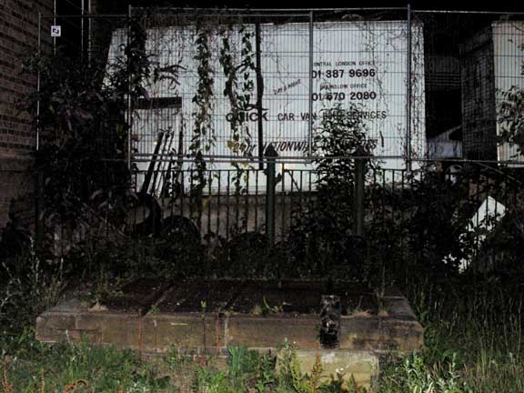
We bid farewell to Wycombe Road
(All pictures on this page (c) Peter Knapp)
We have familiarised ourselves with the indicators for The Way: octagonal gateposts with mushroom-like expansions at their top; hastate railings – often green – with spiked braces cutting diagonally across; small key-shaped markers poking out of soil and inscribed either with the letters MWB (Metropolitan Water Board) or the word “Track.” Then there are the crosshatched steel plates placed upon concrete bases and the odd tumulous-like mound, a campaniled pumping station and a mini-reservoir perched on a hillside overlooking Cricklewood.
Most of all though there has been the extensive but narrow vistas cutting dead straight through whatever has grown up alongside. Like some 17th century philosophical notion of substance, The Way has underpinned the shaping of the phenomena of the civitas. While unacknowledged, The Way has functioned as the tap-root nourishing our futile little lives; a pulsing generator of water existing prior to Heather Mills and Madonna, a God playing with rude toys fashioned of mud and straw.
Now we pass deeper and will bind the A41(T) to the A4(T), creating a conduit of topographic consciousness analogous to The Way itself, a consciousness connecting Golders Green tube station to one of Middlesex’s most iconic buildings.
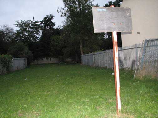
A familiar sight presented itself
We leave Wycombe Road and work further along the A406, passing below the aqueduct carrying the canal over the road, and head towards Hanger Lane. A trading estate appears to our right and, knowingly now, we enter, expecting to find indications of The Way.
The Abbeydale Trading estate consists of a cluster of blocky brick units dating from around World War 2. Many of these are food processing plants serving the Indian restaurant trade. I like these estates as they serve to remind us of the underbelly of highstreet consumerism: There is a continual beeping and humming intentionality acting as a counterpoise to the momentary satisfactions of tikka or halva. The estate is named after Twyford Abbey, a large “cockney gothic” building across the North Circular, which will eventually be covered on this website.And here it is: cutting dead straight through gaps in the industrial units, sometimes grassed over, sometimes concrete covered, is the water main. A little brick utility hut breaks the otherwise barren course of the main, as it strikes southwest towards further lands and zones.
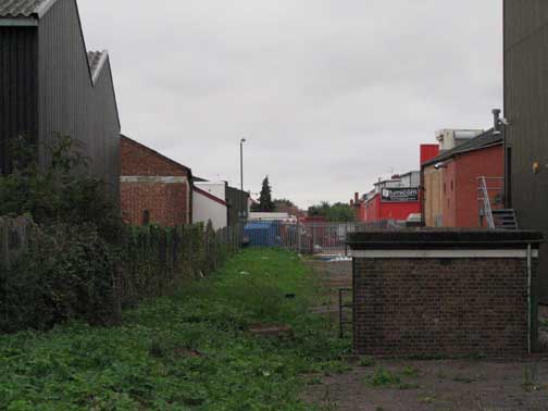
The watermain runs dead straight through the estate
London topographers refer knowingly to a series of aligned roads in Haringey as “the ladder.” 19 short streets ranging from Sydney Road in the north to Umfreville Road in the south form the rungs of this ladder. The rungs are supported by the tough parallels of Wightman Road and Green Lanes. Cutting centrally through all the rungs runs the New River, adding a further element of coherence to the architectonic of streets.
As we leave the Abbeydale trading estate and enter the Abbey (residential) estate we see a similar phenomenon. True, there are only 7 roads serving as rungs; and whilst the A406 serves as a serious analogue to Green Lanes or Wightman Road, the other support, Carylon Road falls a bit short of expectation, being a little old residential street rather than a main route. And whereas the Haringey Ladder has the New River cutting through the rungs and paralleling the support roads on either side, we find here our Way running through, further binding the coherence of the zone. I find the Abbey estate a sad place but am hard-put to say precisely why. An old gentlemen working his garden once told me a little Asian girl had been knocked over and killed just outside his house a few months prior to my visit but I don’t think it was this fact that induces the particular melancholy I feel when wondering about these streets. If there is a general air of futility about the place, the specific cues inducing it -toys lying forlornly in desperately tended gardens, TV screens glimpsed through windows, proudly polished automobiles parked half on pavements – are readily seen in numerous other locations.
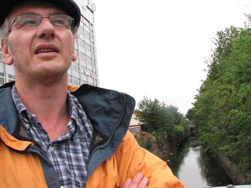
NickP surveys the waterways, July 2006
Even The Way seems to be affected, cutting straight through the monkey house to get clean away as soon as possible; bypassing the slightly down-market suburban house as if sickened by all the chat, all the crap quizzes and biro-scratched lottery forms of life here.I lose The Way beyond the estate though deduction leads me to assume it passes somewhere behind the furniture warehouses with their modern bas-reliefs illustrating leather sofas framed by classical pillars, modelled in moulded plastic or fibre glass.It is after the madness, the beautiful power, of the Hanger Lane Gyratory System that we locate The Way once more, and here the indications will be increasingly strong and pure.
We proceed up Hanger Road beyond the point where the River Brent passes beneath at Vicars Bridge. It is a short walk up Alperton Lane on the left to a sports field, one-time site of the sewage works serving the area before disposal was plugged into the West Middlesex Main Drainage Scheme (about 1935). This place was once the home of the “Wembley Pudding”, processed sludge cakes used for farming and gardening. A Mr Chapman, who managed the farm, grew peppermint on the sludge and so effective was the result the place became known as Peppermint Farm, oil produced here being sold in chemists throughout the region.
The south edge of the sports field is flat and straight-edged and ends in what could be a pumping shed or a World War II bomb shelter – it is a little difficult to decide which.
It is across the next street we come to, Manor Farm Road, that we once again enter the clear presence of The Way. Stretching ahead, a green lane running counter to our sultry afternoon concerns, The Way strikes out towards and beyond the viaduct carrying the electric tube railway between Hanger Lane and Perivale stations. It is eerie, this presence regained, a spirit-familiar doing its job continually throughout our varying stop-offs and sojourns en route. Several times in the next few hundred yards we have the opportunity to gaze along The Way, seeing it from different angles and directions at Lily and May Gardens.
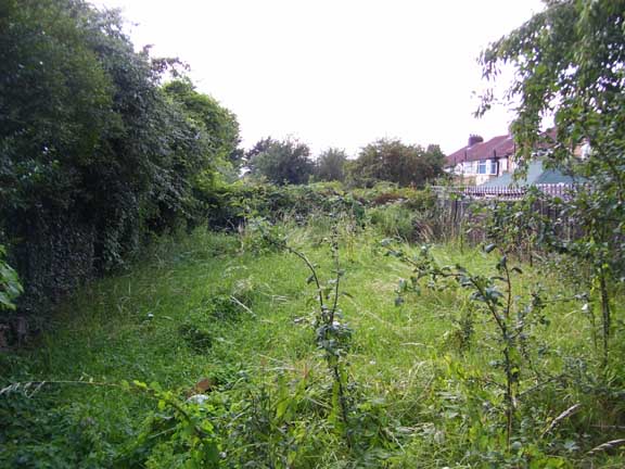 As the thrum of Western Avenue grows in our ears and we begin to fall within the gravitational force field of the Borough of Ealing we see The Way disappear below the edge of a small hill, the spine of which is formed by Rydal Crescent. The water main falls here into perfect alignment with Western Avenue and is picked up again by ascending Rydal Crescent and approaching the A4(T) via Hirlmere Avenue.The rush of traffic forms a crazed backdrop to The Way at the bottom of the road. To right and left the main carries on, bounded by designated grass lands and spied upon by the tops of semi-detached homes. We turn right, and follow through, along the arterial road, unsure here whether The Way has persisted in its general south-westerly route, carrying it across to the A4’s far side, or if it has shifted its axis slightly to parallel the west-north-west of the road. Luckily our green spaces show themselves clearly over the next two hundred yards or so, following the A4 on its north side towards the gigantic Hoover Factory, now a rather grand branch of Tescos. And this is where, once again, I am staggered.
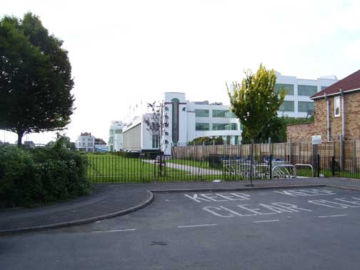
The water main runs across the front of the Hoover Factory
Here is this majestic art-deco factory, a long-favourite of architects and London Topographers. I have passed it many times, on foot or in a friend’s car. It is a singular entity and an integral factor in the region’s landscape. Etc. yet I never suspected when I set out, sensing as I did that my route would bring me close to the place, that the Hoover building was so integral. Slicing clearly across the large grass area at the front of the factory building runs The Way, bounded by and, itself, integral to the structuring of this astonishing temple.
Discovering this I should’ve lain down and wept but, in fact, I entered the supermarket and bought a Mars Bar and a bottle of mineral water. It was the best I could manage by way of paying honour to The Way. To think! When we stood at that little pumping station opposite Golders Green station, when we trudged the straight track of the Vale, cut through parks and suburban streets following the signs, we were already linked intimately with such a far-flung legend as the Hoover Factory. As I walked on towards Horsendon Lane South, a renewed vigour coursing through my legs, I wondered where else The Way would lead me before I finally reached the mystery of its far-distant terminus.

