I travel to North Finchley by bus and then thread through Lovers’ Lane (attentive as always to low points in the footpath’s surface – these may indicate streams crossing on their way to the Dollis) to Swan Lane Park.
What I am after is another glimpse, and a photograph, of a small stream I first stumbled across in C.R.P Lawrence’s Village into Borough (Finchley Public Libraries Committee, 2nd edition, 1964)
Here is Lawrence, on page 4 of the book, where he is describing the geology of Finchley:
So much of the area is now covered with roads and houses that there are few remaining patches of natural open ground where [the] junction between the gravels and the underlying London clay can be traced. One such locality is in the Swan Lane open space, which is an old section of the [Finchley] Common to the west of Whetstone High Road, and, sure enough, a spring flows intermittently there.
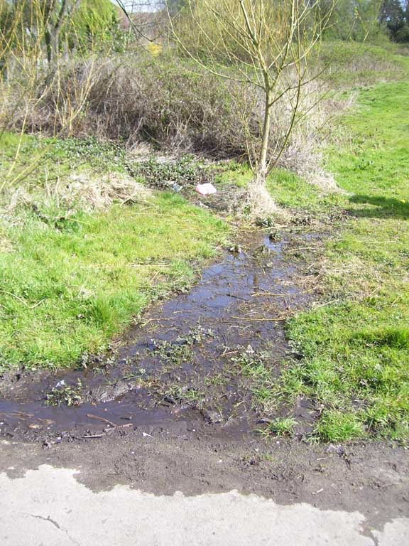
The spring hits the footpath at Swan Lane Park
When I first read the section quoted above – in January 2006 - I hurried off to Swan Lane to see if I could find the spring. I was lucky on that occasion; there, just to the east of the pond I saw water seeping out of the vegetation onto the edge of the footpath before disappearing into a drain. There were also indications of flowing water in the vegetation itself – a dense swathe of dried stems seemed to form a clear run uphill from the footpath towards the east and the High Road. I followed the possible course of the stream noting a swampy course of soil at the stems’ core. Uphill I went to a dank malarial zone of dumped bricks and clay, twisting, slimy saplings and, most disturbingly, half-a-dozen suitcases, wrenched -open and full of mouldering clothes. Clay-smeared trousers and shirts hung from the branches of the young sycamores. It seemed a place of death, this neglected corner of the park. Images swam through my head as I tried to make sense of it all: the bodies of soldiers blown into trees on the Western Front; the lynched “strange fruit” of America’s southern states; the dreaded Tum-tum tree – it seemed as if I had accidentally stumbled across Barnet’s heart of darkness.
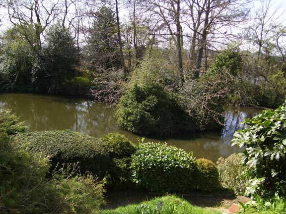
The old lake behind the Barnet Borough
offices at 1255 High Road
My return took place on a fine spring morning and this time none of the darkness seemed present. It had been raining a few days before and once again I was lucky. The spring was in full force, gurgling happily down into the drain. The vegetation too was lush and water-soaked at its roots. I rummaged around in the brambles and the celandines and there was definitely a stream in there. A local told me there had once been a culvert for the stream a yard or two to the north but that it had become blocked up with earth and dead plant-matter. On its original course the stream had presumably been fed under the footpath but its divergence had necessitated the laying of a drain. I traced an apparent spring-course off across the grass to the west – in the general direction of the Dollis down in the valley below. I could see a curve of low ground arching towards the street on the other side of the park’s railings, Swan Lane. Looking more closely a dried streambed was readily apparent in the grass just before the railings were reached. At the base of these – tucked beneath the paving slabs of the path outside the park – there was a small upturned steel grate.
My suspicions had been proved correct. The Swan Lane spring edged northwards on its original course (now diverted via the new drain into a storm water channel presumably) towards an alleyway connecting Swan Lane with Ridgeview Road, a street aligned with the edge of the valley of the Dollis and adjacent to the electric tube railway.
Walk along this towards Totteridge Lane and a succession of dips in the ground indicate the springs running off of where the moraine supporting the Great North Road hits its base of London Clay. Each of the alleys dips bottoms at a manhole’s steel plate. These are inscribed with FUDC – it is easy to forget how far north Finchley’s municipal borough extended.
I trace these springs further back to origin using the dip-in-the-road method. Turning right at Totteridge lane I walk east to Naylor Road (the northern extension of Ridgeview Road) and look down the long straight stretch of tarmac. I see three clear drops in the road surface, one quite close, looking as if it might be taking waters off the old lake hidden behind Barnet Borough’s offices at 1255 High Road. Further off is a dip, corresponding with where I traced the Swan Lane Spring downhill. Finally, another drop (this one so pronounced I see a car disappear into it) analogues with a low-point spotted along Lovers’ Lane earlier in the day.
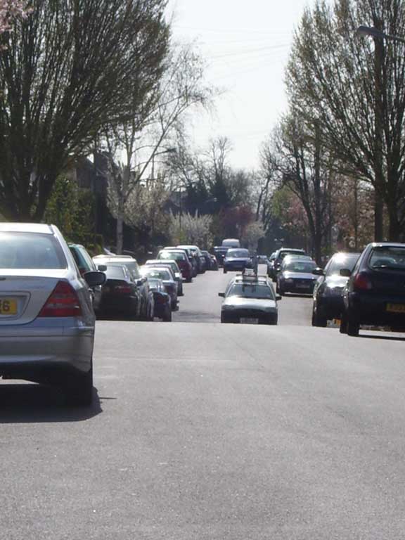
The undulations on Naylor Road
The next road east, Birley Road, has the same sequence of dips. I leave Totteridge Lane temporarily and work down the side of the Council offices to get a picture of the lake. Unfortunately this is hidden behind an estate of new luxury homes and gates and signs indicating private property bar me. I do manage to get a useable photograph however, by leaning uncomfortably over a fence and holding the camera high above my craning neck. The lake is marked on the 1841 Tithe award map and there seems to be a spring rising practically on the Great North Road’s surface that feeds into it. The lake is shown as being placed in land attributed to “House, chapel, plantations, etc” though what this means I don’t know.
Back down Totteridge Lane. I want to see if and where the springs surface before joining the Dollis. I turn off to the left to walk along adjacent to the railway. There is a severe drop in the ground just before the gate to some allotments and a wild patch of emergent woodland to the right. And there it is! A small rill tumbling out of a brick opening deep in the thicket and running off through a strange area of skinny saplings, dumped pre-moulded lintels and rusty old buckets laying in the ivy and the suckers. Everywhere I see septic tanks and washing machines. I see sycamores and thin young oaks stretching towards the sunlight. There are no paths in this odd little zone, no sense of control or green utility. And, of course, I love it. I hear the cars farting along Totteridge Lane. I hear a man shout repeatedly to his dog to come I hear the harsh shout of a teenager and I go deeper into the wood, following the spring as it curves around the base of that high ground built of debris excavated from the railway cutting. They can all fuck off, these smug drivers, these meat-head, would-be, SAS members with their shitting dogs, these future business men speaking as if they were inner-city blacks. I follow the stream, I follow her, deep into memory, deep into the land’s story, into the storage vat of regional memory. For I am a deeply unfriendly man with my twisted specs, my vindictive temperament, my oddball notions born of years of isolation and abuse. And you Dear Reader – you can fuck off too.
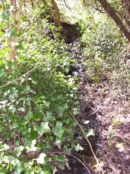
The first of the allotment brooks
I pass through the gate into the allotment area, enjoying the up-down ride along the cement path by the train tracks. There are good views down into the river valley and across to where mythic suburbs rise on the wooded hills of Totteridge-proper. Something in me wants to pass into this vista, wants to unite with it in a kind of lesser samadhi, a prakrti-laya, so I blur and become indistinct, woven into the creosoted fences and the limestone slabs of the suburb’s gardens. I pass into 1926, resurface in 1964. A couple made love in a room rendered water-like by sunlight filtered through swaying boughs outside the wide windows. There are packed and labelled suitcases in the attic, kilner jars stacked in the white-painted pantry. A stunning daughter rides off on her scooter to some club in Soho, 1966. Then cancer strikes and it all fizzles out at the Tum-tum tree, the ruptured poilu of politics, arseholes farting in their four-wheel drives.
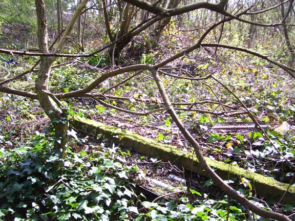
The mad woods close to the first allotment brook
I am delirious by the time I find the next stream and this is a giant! In fact I hear it a good few moments before I spot the yard-wide water-course spurting out of twin pipes – one broad, one narrow – and down into some long neglected allotments. I love it here and recall walking this route back in the late 1960s, seeing a black cat scarper off the rail tracks as a new silver tube train pooted at it to get out the way. I recall picking blackberries and sucking on sherbert lemons on long summer days. And it is all still here, though the previously mentioned high land close to Totteridge Lane is far more wooded than I remember. I saw my first adder up on that ridge, pulling back a sun-heated steel plate and recoiling at the sight of the golden, jewelled stranger. A local tells me slow worms are common thereabouts. A young and silly wagtail flies down from the roof of a shed and lands practically at my feet before hurrying off to the side with that lurching walk wagtails have.
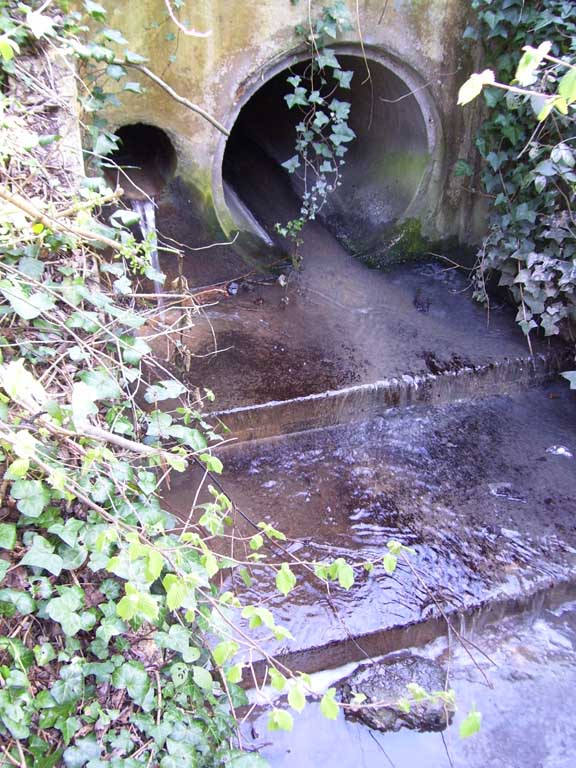
Where the second allotment brook surfaces
I cut down through the allotments along a narrow path I know will be thick with climbing plants come June. At the Dollis I turn right to head back towards Totteridge Lane. I intend to spot the two springs as they join their Mother and I do. The fat spring crosses the grass to the right and is lined with a hedge of blossoming blackthorns and hawthorn just in leaf. The other spring, the skinny wood-dweller, seeps out adjacent to the gruff face of the railway-excavation hill.
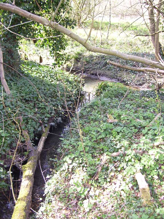
The second brook flows into the Dollis
And here I find what I had previously overlooked. Just before I get to Totteridge Lane he footpath crosses a little bridge. Here, cutting a deep slice through the surface of the slope’s side along by the road runs another stream. There is something powerful and authoritative about this last brook – the last studied for this website. It emerges from a pipe and thrusts down to the Dollis and seems traceable despite having disappeared below ground by a run of thicker vegetation as I head uphill.
The 1821 OS map doesn’t indicate it though there is a suggestion of it on the 1841 Tithe Award map. There is or was a pond here that the Tithe map labels “Public Pond” but I didn’t see it. Instead I wandered off to study the streams running into the Dollis further north. But of this you will never know, Dear Reader, as I have decided to stop my account of the rivers, streams, rills rillets etc of Barnet right here. Enough is enough I say and, besides, I have a book about murders in Barnet to write. I hope you have enjoyed this site. Now, fuck off!

