Time Travel in London, N12
An invisible thread tugs me eastwards off the busy High Road at Finchley Tally Ho Corner. One moment I’m lurching through the impatient, slobbering crowd. Next thing it is as if I am launched into space, surging across miles into fields of light, into lives better than these shoppers and drunks.
To gaze out eastwards off the tongue of boulder clay, the perched roadway, is to disrupt the everyday need or want and throw myself into the larger frame. For this High Road becomes a here, highlighted by a there, “there” being the tree-capped, elongated ridge over on the far side of the valley, the mass of oak and hornbeam we know as Epping Forest. Across successive river valleys it looms, drawing me east on my search downhill…
There are streams running hereabouts, squirting out from the side of the ridge where glacial deposits meets impermeable London clay. Further north, off the Great North Road, to the left, a rill surfaces in Swan Lane Park after heavy rain, visible in a flattening of weeds down the slope from the trees at the top, running across the footpath and into a drain. And there is another here, close to Tally Ho Corner, clearly visible on the 1822 two inch to one-mile OS map, flowing off the high street east towards a confluence with Pymmes Brook.
If you rummage around behind the shops, in the car parks between Stanhope and Castle Road you’ll see very little. An old Finchley Borough manhole here, a suggestion of buried runnels there. We are still in the civitas. Yet look over fences, gazing down into back gardens and it becomes clear that the surface here is a terrace staggering what was once a steep declivity.
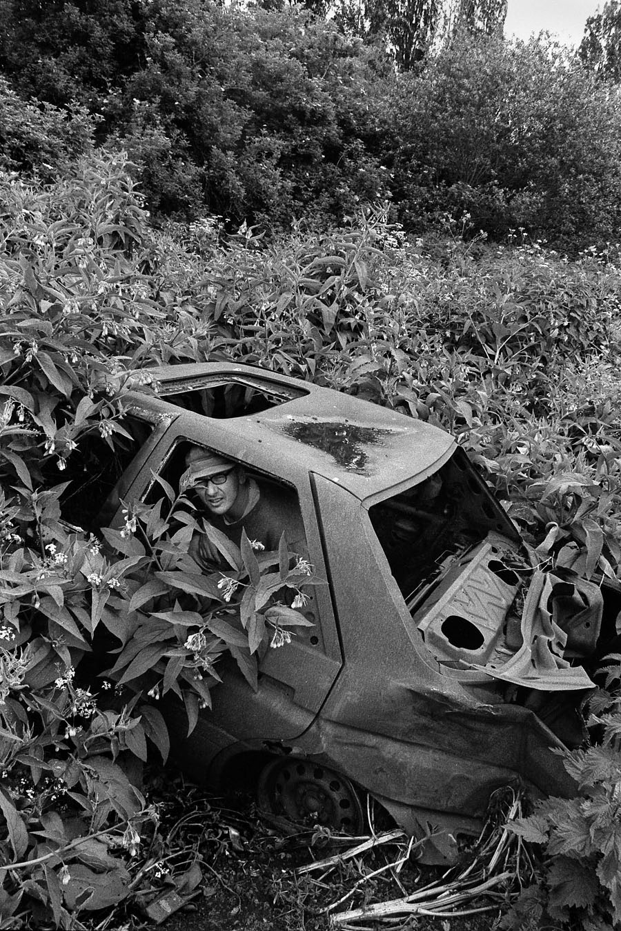
Halfway along our route the car packed in...
It is further down the slope, across Grove Road, we enter the other world. A gate ahead leads to allotments, leads to dropping greenery and those tall, brown, jagged-topped iron pipes that signify sewers. When I first attempted to trace this stream I didn’t gain access to the allotments here. Instead I walked slightly north and then along Friern Park checking the imagined route of the stream against my maps until I stopped in shock and realisation.
To the right, behind a 1920s block of flats a broad steep-sided green swathe clearly spelled out the presence of a river course. I was literally looking across a valley to school buildings and suburban houses. A tear seemed to have been rent in the fabric of business, of Sunday afternoon sport on the telly. It was 1913, pig farms and haymakers all over again.
Later, a cluster of streets named after towns in Sussex shook me. I descended Torrington Grove to Lewes Road to move into alignment with the theoretical river. There, at the lowest point, where Buxted Road ran off to the left was a dip so steep that I saw, superimposed, a lane running down to ford a muddy stream in days before suburbia encroached on the scene.
On the right was a green space, its lower end in line with the river’s supposed course. I thrust here, through nettles to trees, finding an ancient butt within their shade; its still black water was scattered with white petals. Rummaging close to where the trees and briars backed up against the ends of gardens I saw what was once the surface course of the stream in an ash-lined gently meandering bank edging a ditch-like drop in ground level.
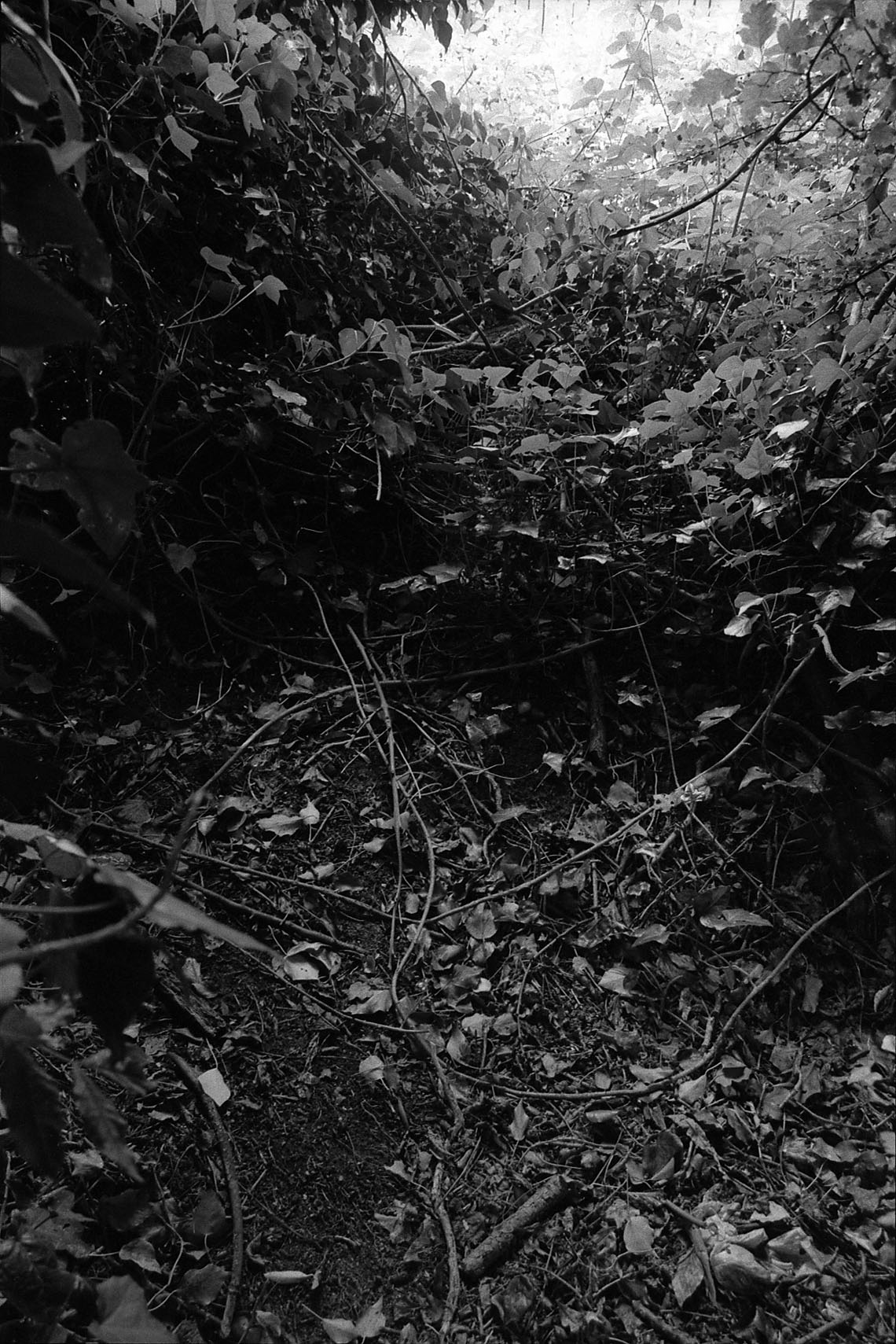
The old riverbed at the junction
of Lewes and Buxted Roads
It looked like a dried out riverbed. Possibly the intervening years had seen the stream forced under ground as a subterranean storm-water conduit servicing the growth of dwellings in the area.
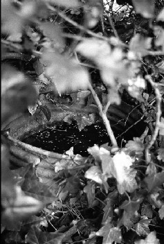
The Butt, hidden within the undergrowth
Buxted road is clearly in line with the river bed. Ahead it runs, closely following the lowest ground hereabouts though the riverbed seems to run behind the houses on the left side about half way along the street. Buxted Road incidently, hosted the home of Arthur Alfred Rouse, who killed an uknown man by setting fire to his car in November 1930 - an offence for which he was hanged. An alley coming down from Friern Park possibly indicates the point of confluence between my stream and Blacketts Brook, the watercourse that cuts along the edge of nearby Friary Park. This stream has its source far up near the glacial moraine carrying the Great North Road, in the grounds of the North Middlesex Golf Club.
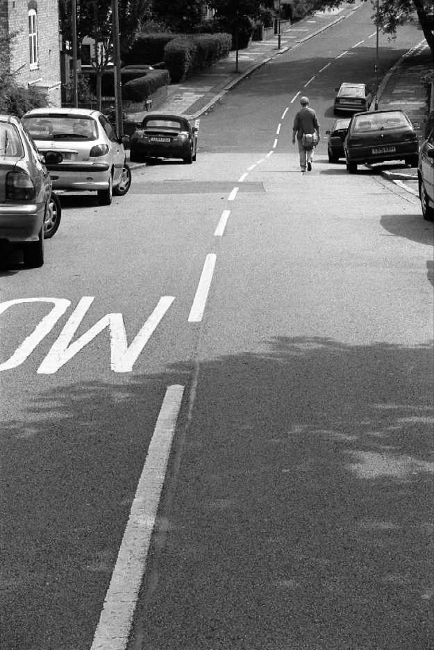
The river course is clearly visible at the
Junction of Lewes Road with Buxted Road
At the junction of Buxted Road with Friern Barnet Lane I looked ahead, across to an extended green alley running between the houses. Peering over the fence here I saw this course disappear ahead, beyond my reach. After consulting my 1982 edition A-Z Master Atlas of Greater London I worked my way along Friern Barnet Lane and right, down Hatley Close to where that road ended in a little cul-de-sac, once more dropping down to what was obviously a river bed long-buried beneath tarmac.
So it ended, that time, the day finished off with explorations of St James’s Church in Friern Barnet (where I sought the grave of my Great Grandfather, John Cobley Robotham) and an illegal visit to the golf course tracing the source of Blackett’s Brook.
A week later I was joined by Pete Knapp, photographer and archivist, and we duplicated the walk described above. This time we accessed the allotments at Grove Road. The Secretary of the allotment verified that the ground along the lowest point of the transverse valley here was frequently sodden. Manhole covers marked with the FUDC of Finchley Urban District Council indicated sewers running down hill, presumably alongside the hidden stream.
Having traced my previous visit, Pete and I endeavoured to follow-through, chasing that stream to its inevitable confluence with Pymmes Brook. Blindly we thrust ahead along the road to the immediate north of Hatley Close. I was concerned not to miss the confluence between our brook and another stream rising just beneath the Great North Road. This was a stream that roughly parallels Blackett’s Brook. Earlier searches far up near Whetstone Police station had revealed no clues as to its presence and I wanted something – some undulation in street level or meandering margin of estate – that spelt out its course.
The road we walked, The Ridgeway, ended too far up above the valley floor but a right, down Bethune Avenue and along The Crescent brought us to a likely looking spot for the confluence I so sought. On the left a vast allotment garden seemed to carry the land in a way that screamed “Old River.” Winding ahead before us, this zone of urban agriculture was clearly set on a hillside. I could see, with some sort of developing inner eye that a stream had flowed down here at some point in the past.
The allotment’s tenants were very helpful, citing damp spots, myths and rumours in an attempt to verify my suspicions but nothing very substantial was visible. Still, there were other things to examine. I was distracted by the dazzle of a couple of metallic-looking beetles snoozing in a nearby corolla while Pete snapped away at a curious seeding incubator, fashioned from doors and window frames and topped with a pair of ornamental bowls. The lady who owned it proudly credited a couple of strapping lads who’d built it for her. They nodded to us and got on with their work. All life clusters alongside these streams.
At this point in our explorations we had still seen no direct evidence of the existence of the stream we had “followed” from North Finchley. Rather, there were suggestions in the sweep of the land, its folds and patterns. We moved on, hoping for proof of the stream's continued flow further downhill.
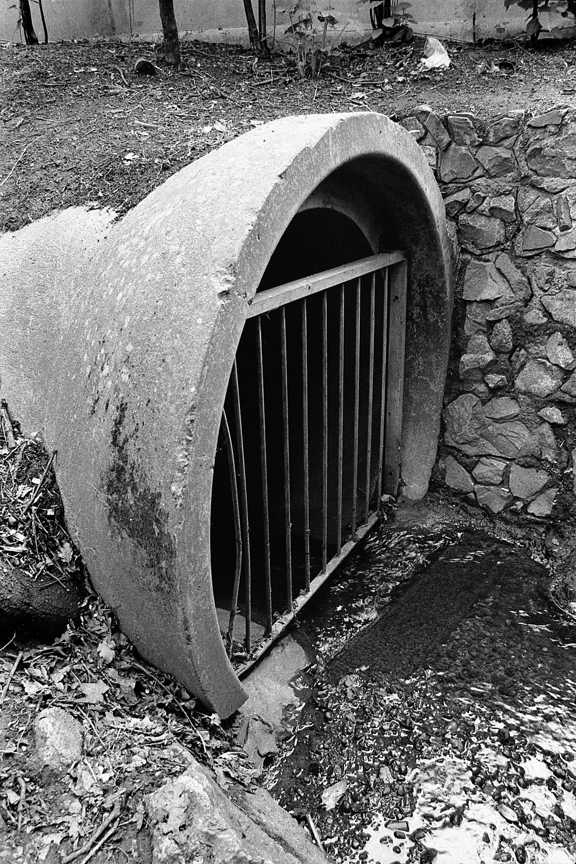
Where our stream surfaced close
to the Pymmes Brook
We had to work across the mainline railway and onto Oakleigh Road South before we could regain the scent. Somewhere in close alignment with buried water mains served by the reservoir hidden beneath the trees at the railway’s edge, ran our stream.
We edged through along timely alleyways to Brunswick Park Road where a low-point in the road told of the stream’s continuing presence, in some sort of topographic memory if not in fact.
Pete and I estimated it ran through the little trading estate opposite and down somewhere near the circular network consisting of Ryhope, Pymmes Green, and Dale Green roads. Reaching these streets we found verification in a low wallow of road surface leading to long alleyways hiding garages, behind the houses on Pymmes Green Road. We probed here, gasping at sudden silence after traffic all day, in a weird area suggestive of a long-lost lane. Up between a pair of houses we entered Waterfall Road opposite where the Pymmes Brook flows through Arnos park, winding beneath the viaduct carrying the Piccadilly Line over the river valley.
Taking the roads low point as our guide once again, we gazed through a madness of sycamore towards where the Pymmes Brook flowed past. There, emerging into daylight for the first and only time, verifying all my theories, justifying all our nose-to-ground reading of landscape, our stream emerged from a brick-lined tunnel mouth, gushing those last few yards of its course into the Pymmes Brook from where these waters will flow to the Lea and the Thames.
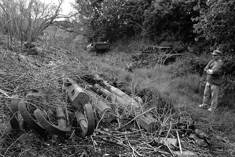
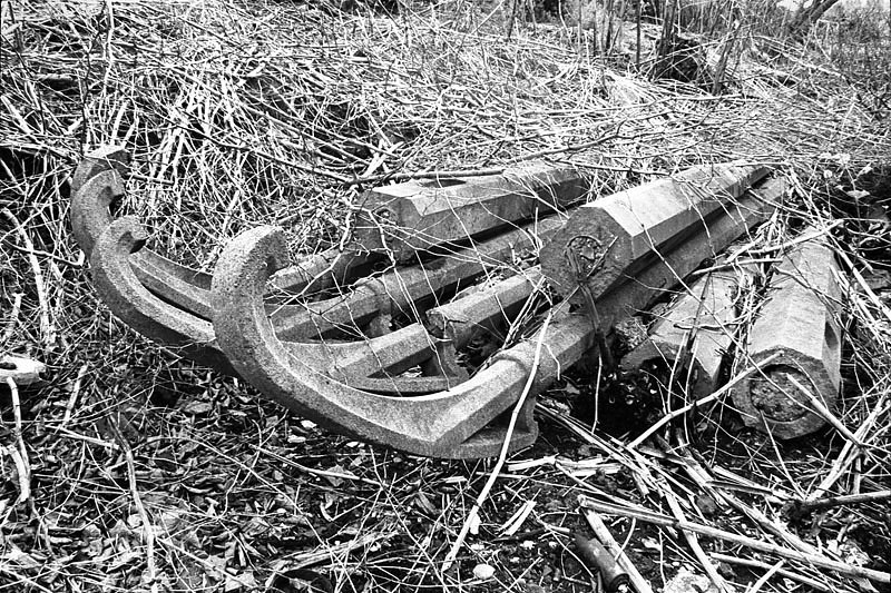
The Streetlamps' Graveyard. Decommissioned premoulded lamps dumped on the site of the old Friern Barnet Council Sewage farm
The Strawberry Vale/Bounds Green Brook
Pete and I walked up Brookdale and attempted to procure sandwiches at the little parade of shops by Arnos Grove station. We were moving on, intent on following up our success with another coup. We worked downhill towards the A406 chasing other memories, fragments of knowledge. I wanted some pictures of the Strawberry Vale Brook where it runs in line with the North Circular and, besides, I had promised Pete I’d show him the Street lamps’ Graveyard.
A few years back, while tracing the history of my family, I had hung about on the edges of the so-called Freehold estate, a formerly jam-packed mass of shoddy dwellings adjacent to the old Friern Barnet UDC sewage works. The works had been decommissioned in 1963; wastes then being run through to Deepham’s Purification Works in Edmonton as part of the East Middlesex Main Drainage Scheme. Part of the site became a public park and the rest a dumping ground for cars and plaster. I had probed through the marshy madness of the site and uncovered piles of pre-moulded concrete street lamps lying amidst dried stems or a tangle of nettles and comfrey, depending upon the season. Pete wanted to see these relics of an earlier stage in the evolution of the A406 and so we went across the North Circular below the old Halliwick Hospital and through decrepit hastate palings into a writhing overstorey of Willows.
This whole area is a meeting place of numerous streams: two come down from off the Muswell Hill and at least one runs down from the area around Friern Barnet town hall. These all meet with and join the little Strawberry Vale Brook – soon to become the Bounds Green Brook as it flows by the North Circular towards its meeting with Pymmes Brook.
The A406 North Circular runs along the near-bottom of river valleys throughout its course. Think of Mutton Brook joining it as it lurches towards Henley’s Corner. Think of the Brent quietly echoing the road as it runs by Brent Cross. And keep an eye out for the Pymmes Brook and the Salmon Brook as our road approaches its crossing of the Lea. A chain of river tributaries align with its course right through from beginning to end. Why is this?
The NCR was designed back in the 1920s to provide a fast cross-link through the new suburbs then sprouting up in Middlesex. The old roads which preceded the NCR had tended to hug high ground which was easily drained and carried sparser vegetation. Think of the Great North Road following its line of boulder clay, taking what was, at that time the shortest feasible route across transverse valleys to the next slope along. The land down in the valleys, along the flood plain gravels, was too boggy to allow for drainage and, besides, deciduous woodlands were difficult to clear.
The planners from the Middlesex County Council who built the NCR were not put off by such difficult conditions. By the 1920s technological know-how and road-making machines enabled them to select an optimum route for their road. The A406 follows vales and cuts through highland, taking the shortest possible route between townships and suburbs.
The NCR was completed in 1934. At that time open fields and woodland bordered it. Factories and warehouses later superseded these. The NCR, with its vast tarmac surface area, necessitated and, in turn, provided the material support for laying out the West - and East Middlesex Drainage Scheme with storm water and human waste following the course of the road (and the rivers) to Mogden Purification Works in Isleworth and to Deepham’s Treatment Works in Edmonton.
The section of the NCR where Pete and I ended up was actually the last to be laid. Pinkham Way, as it is known, is named after Lieutenant Colonel Sir Charles Pinkham, chairman of the Middlesex County Highways Committee at the time of the NCR’s completion. At one time a tree marking the formal opening stood in the centre of the roundabout at the junction of the NCR and Colney Hatch Lane. In the 1970s a flyover replaced the roundabout and the tree was lost to posterity.
Two difficulties concerning water were encountered during the building of this final section of the NCR. The Strawberry Vale Brook had to be diverted and culverted to a length of 400 yards at a cost of £12,000. The culvert is still there, hidden in dense brakes of foreign shrubs by the road’s side.
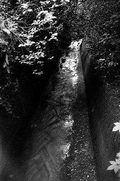
The Strawberry Vale Brook running through its culvert
The second problem concerned waste water from the Friern Barnet asylum.The main sewage outfall from the hospital crossed the site of the road by an overhead pipeline carried on concrete piers. The headroom being too low, it necessitated to construction of an inverted siphon to carry the waste. This is still visible curving out over the Strawberry Vale Brook below the sculpted landscape of the new trading estate behind the old hospital.
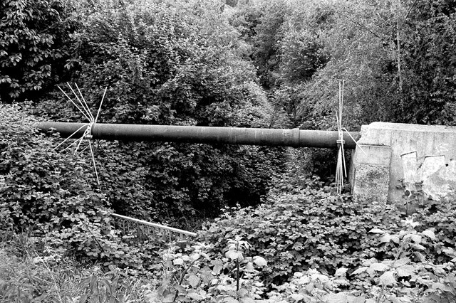
The inverted syphon, built to carry sewage waste
from the Halliwick Hospital across the Strawberry Brook and the A406 to the now disused Friern Barnet Sewage Farm.
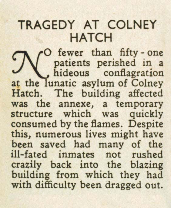
In 1903 Halliwick was the scene of the worst hospital fire ever recorded in Britain. Three wooden huts caught fire and 51 patients were killed. The hospital has latterly been converted to flats. I noted, on a visit a couple of years back that the county coat-of-arms above the building’s entrance is that of Essex. Does anybody reading this know why?
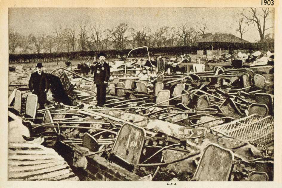
The scene on the day after the
Halliwick Hospital fire, 1903
Strawberry Vale Brook has its origins on the watershed around the old Finchley Manor House on East End Road. It flows through the allotments wedged between the NCR and Long Lane, Finchley, and cuts through to the St Pancras cemetery via a concrete pipe laid out in wasteland behind the houses on the south side of Glebe Road. Before this it takes a tributary running down alongside Queens Avenue. On its course through the cemetery it is joined by additional spring running down from Muswell Hill and through Coldfall Woods. Other rills join Strawberry Vale Brook near to the Summers Lane estate. This whole area was once a veritable Avebury of sewage farms, waterways and conduits and warrants close investigation at some future date.
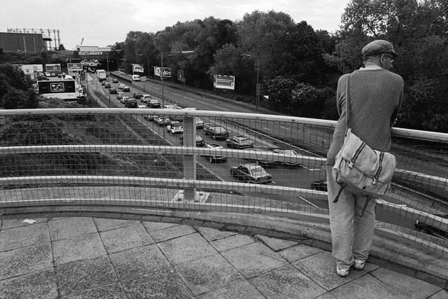
Journey's End above Pinkham's Way
(B&W Photos: ©Peter Knapp)

