
It is generally taken that the Dollis is the primary river of the Borough. Following its confluence with Mutton Brook the Dollis “becomes” the Brent, the feeling being that this is simply a renaming of the former stream rather than an acknowledgement of changed circumstances due to two rivers combining.
The Dollis therefore overrules the Silkstream, which is seen very much as a daughter river despite its considerable size and length prior to their confluence at the Welsh Harp. Either way, the Dollis/Brent is the dominant river system of the region. The catchment area for the river totals 67 square miles.
Prior to the formation of Barnet Borough in 1965 the Dollis formed the boundary between Finchley and Hendon boroughs. Towards the end of their roles as effective administrative areas the twin boroughs worked hard to incorporate the river into the greenbelt as a leisure facility. Alfred Pike, mayor of Finchley in 1937/38 and again in 1958/59, recalled the situation in an interview recorded in 1980 and included in Percy Reboul’s book Barnet Voices published in 1999:
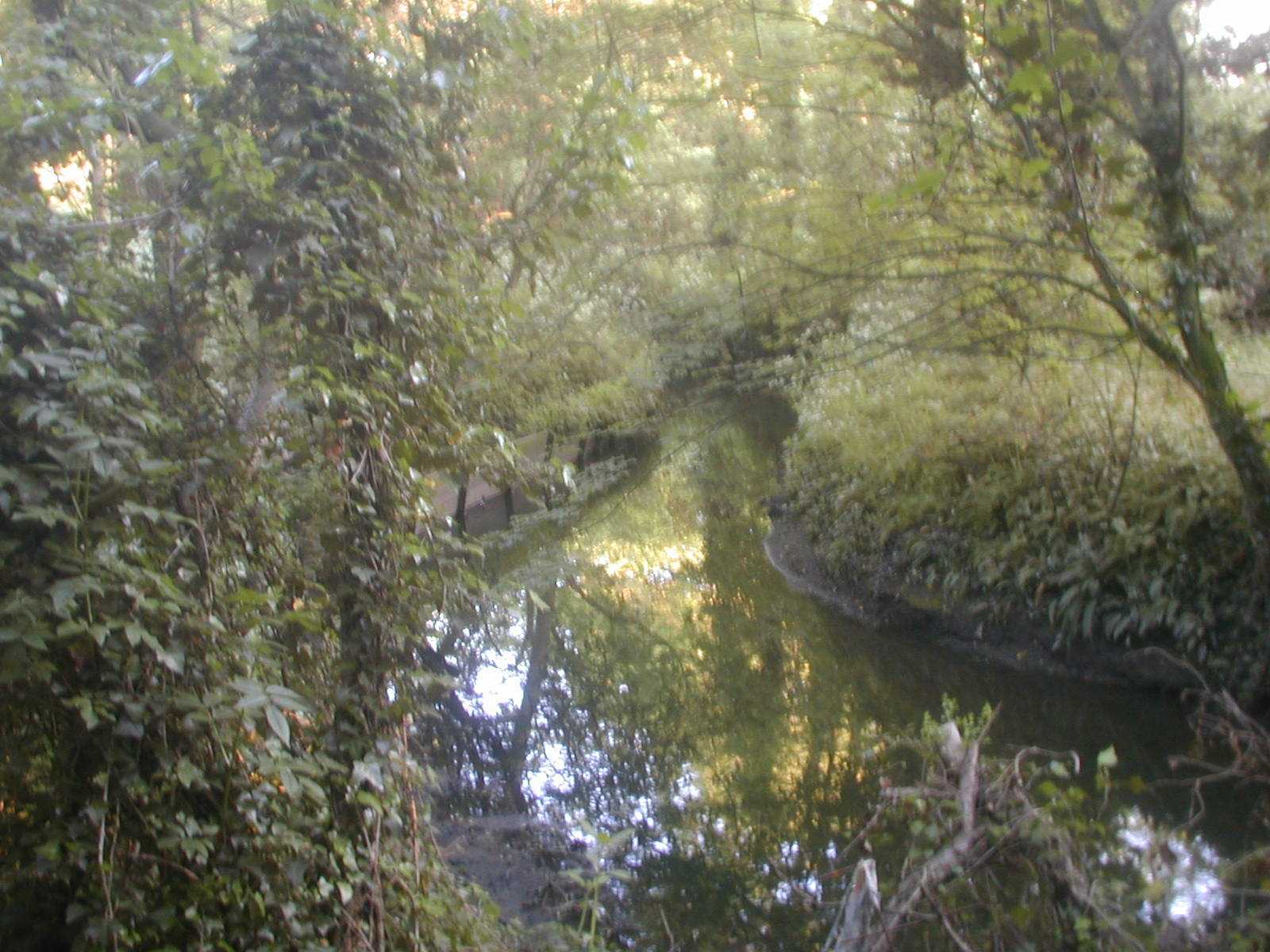
The Dollis approaching its confluence with Mutton Brook
(where it will become the river Brent)
One of the things I attach great importance to is the Brookside walk. It starts at Falloden Way, in the Garden Suburb, goes along the brook to Henley’s Corner, crosses over and goes up to the borough boundary. Now I was in Cologne for a conference between the wars and was taken by their town clerk and Burgomaster around the original town walls which had become a public walk with lovely gardens. I thought, why can’t we turn our brook-side into a walk? I worked away at it and Finchley Council agreed to pursue it but when we got as far as Westbury Road where the gardens went right down to the brook, we were bunkered. Our only hope was to see if Hendon would acquire the piece of land on their side so that we had a crossover. I discussed it with my opposite number in Hendon and he thought it a good idea so now we get Westbury Road , cross over into Hendon and go right along to where Lullington Garth starts and then back eventually into Finchley.
However, not everybody was pleased with the way the Council went about fulfilling Pike’s plan; consider the following letter, sent to The Finchley Review in July 1937:
3rd July 1937
Dear Sir, - Only a year ago the area between the gardens of this part of Village Road and the Dollis Brook was as pretty a spot as you could wish to see. The old bed of the stream wandered through a copse of beautiful trees and elsewhere there was a green meadow.
In the summer of last year the Finchley Council acted. Thick logs of trees were thrown into hollows. Lorry after lorry drove up and deposited poor soil mingled with bricks, stones and all sorts of odds and ends.
Soon the meadow had become a desert in dry weather, a mudflat in wet; and in any weather a rubbish dump. Trees and bushes were hewn down to make way for lorries. To the former loads were added others less pleasant, street sweepings, dirty paper and rags, and the cuttings of the local trees.
It took weeks to complete the work of vandalism but at last the Council were content. Gashes had been rent in the bushes, trees and branches had been torn down and over all the pretty spot was spread a hideous desecration of weltering mud and a muddle of brick and stone.
What was the object of this philistine idiocy? If the Borough Surveyor thought to drain the ground, never was a surveyor proved more wrong. The winter rains deprived of their natural drainage via the old bed of the stream, collected in a system of rank pools and lagoons, on the top of which floated the oil risen from the buried road scavengings.
The Council was compelled to dig drainage ways late into the spring.But the full extent of the stupidity is only just revealed. Many of the trees, many of the bushes are dead and many more of both are sickly and dying.
So that the good people of Finchley may enjoy the patch of wantonly destroyed natural beauty, a beneficient Council has scarred the fields with a black asphalt path – Brookside Walk.
And the irony of it all is this: a few days work clearing the outlet of the old bed of the stream into the present Dollis Brook and the winter rains which used to gather in the ditch would have had free egress.
Ah, dear Editor, but I’m forgetting, that would have denied the Council the delight of turning meadow into desert, woodland into a desolation of dead wood and a satisfactorily drained area into a system of evil-smelling lagoons.
Two minor pleasures would also have been denied to the Council. The pleasure of burying wood which might have been firewood for the unemployed, and the pleasure of spending public money on an entirely useless object.
Yours faithfully
Ralph M. Dowson.
12, Village Road, London, N.3.
OS maps of a hundred years ago indicate extensive field drainage systems along the course of the Dollis. While many of these remain (or have become incorporated into surface-water channels beneath suburban streets – see below) the river no longer serves exclusively agricultural interests.
The build-up and suburbanisation of North Middlesex during the 1920s and 30s exacerbated drainage in the area. the hendon and Finchley Times for 7th November 1930 contains the following report:
Consideration has been given by the General Purposes Committee [of the Middlesex County Council] to the application of the Finchley Council for a contribution towards the cost of aquiring two small pieces of land for additions to the Public Walk, which it is intended to run along the banks of the Dollis Brook, the boundary between the Finchley and Hendon urban districts. There is planned a surface water sewer at Wyatt''s Farm, Whetstone, at a cost of £200...the land which is situated on the west of Fursby Avenue and Brent Way was inspected by members of the Committee. The Council agreed to contribute a fourth of the cost.
If you walk along the Dollis between, say, Holders Hill Gardens to Thornfield, you will spot a staggering number of pipes issuing from the embankment above the stream, carrying surface water from nearby streets. Drainage water running off the dense road network in the catchment area of the river has resulted in occasional flash floods. Back in 1968 torrential rains caused several sections of the Dollis/Brent to break its banks, resulting in widespread damage. The GLC subsequently issued a leaflet to homes in the area. The River Brent Valley and You
 The Dollis Brook was an abiding presence throughout my childhood. A walk through suburban streets took the family to Ballards Lane, familiar for its shops and bus routes Then along Lovers Walk, between high old walls and over the railway line where train drivers hooted to us. Crossing the busy road at the Lane’s end we came to a lodge house at the top of a tree-lined walk. It was like entering another world. A slope ran downhill with horse chestnuts on either side and a wide ditch to the left backed onto garden fences. A few hundred yards more of tarmac and water and there, ahead, was the brook.
I think Lovers Walk probably covers a waterway, presumably the one that emerges by the lodge house on Brent Way and runs down alongside the tarmac track to the Brook at the bottom of the valley. Note there is also a path side ditch running south directly opposite, from somewhere up near Nether Court, the clubhouse for the local golf club. A further stream rising near Nether court flows through the golf course and empties into the Dollis through a concrete-wrapped discharge pipe opposite Brent Way. A look at the 1894 OS map of Finchley reveals that all these ditches were present at that time.
 Having reached the brook we would put on wellington boots and play in the shallow water, hopping from gravel bank to gravel bank or plucking dock leaves to salve stings from the nettles which grew everywhere. Sometimes the river was frothy with detergents – quite a common site in those days (see a refernce to this phenomenon in Philip Larkin’s “The Whitsun Weddings”) but thankfully this stopped happening after about 1964. One day we followed along the river from the bridge that usually formed our starting point to the vast hallways of the viaduct carrying trains high over the trees and the rooftops of the houses nearby. I stepped on a piece of wood with a nail in it and it pierced my boot, entering my foot. For months afterwards gently tickling the wound would induce unbearable spasms of delight – my first masochistic impulses.
There was a fine graffito in large white letters on the base of the railway viaduct: EDUCATE THE USA. The large message, visible to passing drivers pointed to a darker, turbulent world beyond our experience.
In 1972 my younger brother Stavro, my friend Nick Fields and me climbed high through successive brick chambers of the viaduct up to where the trains rumbled overhead. Here we found a used syringe lying in the bare dirt in this sun-occluded place. We phoned the police from a phone box and told them of our find. “OK lads, thanks for the information. Don’t touch the syringe and we’ll send a panda over later to pick it up for fingerprints.” We waited and waited for that panda, standing beneath the trees until the street lights were turning red in the early evening before we went home. 30 years later a similar syringe was to kill my brother.
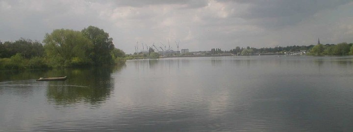
The Brent and Silkstream meet at the Welsh Harp
There was a small wooden bridge at the bottom of the track running from the lodge house. It is still there but in about 1965 it was joined by an aluminium structure spanning the stream and, presumably, carrying water, gas or some such utility across to the opposite side. I still think of it as the “new" bridge whenever I visit.
On another occasion we went fishing in the lake between the brook and the golf course. We caught dozens of sticklebacks and newts and took them home together with water weeds, placing them in a large blue plastic bath only recently used to bathe my younger brother. I was struck by the sticklebacks swimming around in circles all together and would watch them for hours. I rushed home from school shortly after, eager to see the fish. To my horror they were all dead, their gills white and eyes black and lifeless. The water was yellow and stinking. With a howl of rage I took the plimsoll to my unfortunate brother.
About 1966 we explored further, crossing busy Dollis Road and entering the long narrow strip of parkland running alongside the brook. I remember one day seeing a young man cycle past along the path dressed in a bright red hussar’s jacket!

July 2007: pollution froths the Dollis at Hendon Lane weir
I also recall one hot afternoon in 1968 staring idly at the rundown old tennis huts in the patchy riverside land behind Brent Way. It was the day of the opening ceremony for the Mexico Olympics and I was due home about teatime to watch it on the goggle box, I mention this because it seems so recent, so outside the sequential flow of my life, this event, this staring idly at the decrepit Tennis hut. Rather like the streams and waterways themselves in fact.
The Dollis rises in Barnet Gate Wood, way up near Moat Mount in the north of the Borough. It flows eastwards initially, taking in additional waters from subsidiary streams and from fine roadside ditches along Hendon Wood Lane.
The Dollis eventually curves southwards alongside the long tongue of glacial gravel mounting the Great North Road between Barnet and Finchley Tally Ho Corner. From there the Dollis runs below the Hampstead Heights in a valley far below the Finchley Road. All along the road from Barnet to, say, a little beyond Long Lane, Finchley, the traveller is struck by the fall of land westwards. Around Finchley Central station the view westwards becomes blocked by the wedge of gravels jutting out from the Finchley plateau towards the point where Dollis and Mutton conjoin but, travelling south, one is eventually rewarded with even better views down into the river valley
The best place to see this is by looking down Dunstan Road, just to the south of Golders Green. Extensive views across the valley carry the eye right across to Harrow on the Hill and even further. Deep below the river runs, bearing slightly west as it receives the waters of the Mutton Brook and turning towards its expansion at the Welsh Harp.

A tributary feeds the Dollis, coming off of the gravel beneath the Great North Road at Prickler’s Hill, just adjacent to the old Middlesex and Hertfordshire county boundary. I have never seen this tributary (or not knowingly, anyway. I mean, I have never noticed it) but have read about it in an old Times article dated January 19th 1911:
At Highgate yesterday S Morris, proprietor of the Whelm Laundary, Great-North-Road, Barnet, was summoned for not having complied with two notices issued by the Middlesex County Council calling upon him to discontinue the flow of sewage or other offensive matters into the Dollis Brook, a tributary of the Brent.
It transpired that the unfortunate Mr Morris had missed out on modifications to sewage disposal dating from 1906 when an estate on the east side of the main road had been processed integrated into a local UDC system. Mr Morris’s business was located on the west side of the road and had been overlooked. The defendant decided to take proceedings against the County Council. The sluice is quite likely the one visible on modern 1/25000th OS maps.
As mentioned on this site’s main page, there is another set of tributaries joining the Dollis opposite the Hendon Cemetery.Three watercourses meet in the Cemetery. The southern-most flows in from across an adjacent golfcourse having risen on Arandean Hill, a mile or so to the north. Another rises to the west of the former, possibly picking up waters flowing down the long roadside ditch on Milespit Hill. It is clearly visible below Sanders Lane where that road rises to cross the disused railway that once ran between Mill Hill and Edgware. It runs along Ashley Lane and crosses into the cemetery picking up another stream running down through the site of the old Mill Hill gasworks.
The river is not only a benign relic of the arcadian past or an ideal green utility:the stretch of the Dollis between Hendon Lane and Bell Street was a scene of tragedy back in 1959 when Hubert James Dughard, a 21 year old Indian plastics worker from Muswell Hill strangled a local girl, 19 year old Miriam Young and threw her body in the brook just adjacent to the large watersplash. Dughard subsequently received a life sentence.

Watersplash, dock and long-disused bridge
behind bungalows on the A406
At the junction between the A406 North Circular Road and Brent Street the river drops through a watersplash. There is a pair of curious conical summerhouses, one on each of the river’s banks. These are the final remains of the Brent Bridge Hotel, a once-popular meeting place in the region, which stood on the site of what is now Woodbourne close
.

The sunhouses at Brent Bridge: last remains
of the once-popular Brent Bridge Hotel
Further west, at a point yet undetermined, a small boy, 6-year old John Frederick Petts of 139 Woodstock Avenue drowned while playing in the river back in 1919.
There is a small bridge dating from somewhere around the 1930s still standing on the stretch of the Brent between Brent Street and Brent Cross. The bridge, marked on the 1936 6-inch-to-one-mile OS map is accessible through the garden of a derelict bungalow on the A406. It is at the point corresponding to where Mayfield Gardens forms its junction with Shirehall Park on the river’s north bank. There is also a weir just there and a concrete pier which may be the dock marked on the 1894 map. I went through to visit the bridge in February 2005 and found it covered in ivy. Inscribed in the concrete of the river bank was the inscription “1939 HMG.”
The straight section of the brook to the immediate east of Brent Cross was the site of a further murder in 1921: the body of a woman, Mrs Evelyn Goslett, wife of Arthur Andrew Goslett was found in the brook directly opposite the end of Western Avenue. She had been bludgeoned with a blunt instrument. Police enquiries led to the arrest of her husband who was eventually hanged at Pentonville prison for murder.
(c) Riverrun 2004