
Where Riverrun Barnet begins...
To be precise, I looked round me and wondered if there wasn’t a well thereabouts, perhaps in the house’s back garden. A well, or a waterway rendering the sign more than purely decorative. And you know, there was…
The land drops down steeply from behind the house, descending across the artificial plain of the old Hendon Aerodrome (now the Grahame Park Estate) towards the Silk Stream, that close-runner to the claim of London Borough of Barnet’s premier waterway. Shorter, narrower, perhaps in some ways prettier than the Dollis, the Silkstream could be seen as the little sister of the pair. Across the A41 towered the mass of Hendon, Sunny Hill Park with its views westwards and what I call the Sunningfields promontory, a sandy spur covered over with roads containing some of Hendon’s earliest “quality” suburban villas (such as Sunningfields Road, hence the name). Was there a stream perhaps issuing from somewhere off this high ground and running downhill, under the main road and through the grounds of the house?
That evening I consulted my collection of old maps and found there was a tributary of the Silkstream close by the house’s location. I went out to read the land a week or so later.
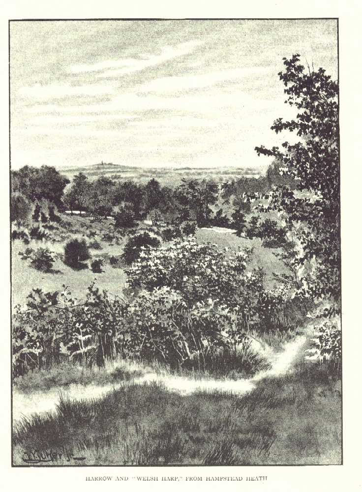
Sunnyhill Park provides extensive views to the west, over to Harrow-on-the-Hill, Haste Hill near Ruislip and the chalkdowns at Harefield, on Middlesex’s margin. The railway north, M1 Motorway and, of course, the A41 all gently curve below, towards their respective gaps or tunnels in the South Herts tertiary escarpment a few miles away. In the 1920s and 30s crowds assembled here to watch the air pageants held on the aerodrome below. It was a likely spot for streams though their precise course is difficult to discern. Working north along the parks highest point from Hendon church one sees several likely gullies, occasional damp stains running down into the valley. These often align with gaps in the houses clustered below. Further on a line of old hedgerow descends the hill, a small rill hidden in its base. I will not itemise all of these courses just yet as it is with the specific prompt, the stream that initiated all this exploration that I am concerned right now.
It is towards the north of the park, after the high path drops down to an intersecting track leading to sports huts and a teashop, that a damp stain can be seen running along the grass’s lowest point. Aligned with this dampness are a set of manhole covers and curious undulations in the ground surface suggestive of a riverbank. The watercourse comes down off the high ground to the east, off the Sunningfields promontory. In fact; it heads in the direction of the park gates and the A41, probably taking additional waters off the long drainage ditch running along a large part of the park’s western edge, where this backs up against the gardens of the houses just there.
A look at the 1822 OS map of the area shows a small stream running down to join the Silkstream from the high ground of Hendon via a gully. Further, the exit to the park, through which the possible stream ran, was more or less opposite the Irish direction sign. Actually the stream does run here – though I know longer recall how I verified this as the relevant notebook was lost last year, left in a telephone box in Camden Town. After leaving the park it turns north before crossing beneath the A41 and curving back south.
I crossed the main road via the subway there and turned a little up Wheatley Close, where some new brown-brick houses had been built. Looking over the fence of a house I saw my stream. It was running along behind the houses in the general direction of the home with the Irish street sign. So I was correct: the sign was more than merely decorative; rather, it was placed to honour these wellsprings and echoes that underlie our turbulent everyday madness. I was also aware that in following my hunch, in being attentive to the screened-out land and its shapes. I had linked up with a kind of older mind, a mental correlate to the planet’s forces buried deep within the cortex. There was a sense – to be duplicated again and again, of linking up with the past, or with processes operating at a different magnitude to the snap-shot of a million-year process that we take as “reality.”

Which version of reality exactly...?
The "Alleyway Brook" heads for the A41
I found upon further investigation that “my” stream actually ran to the south of the old aerodrome, crossing Aerodrome Road and passing through the grounds of the Peel Centre. It is visible as a slight elongated undulation in the surface of the Police College’s sportsfield.
The stream eventually flows under the underground railway, across a fragment of woodland, under Colindeep Lane and into the Silkstream through a concrete-sided outlet in Rushgrove Park. For the huge bulk of its course it is buried below ground. I call this stream the Sunningfield Brook for no other reason than that I sense it rises somewhere close to the street with that name.
I was pleased at what I had found, at the verification that I had some ability, however slender, in the field of topography.
This is how this website, Riverrun Barnet began. A week or so later I started a three-month course in web-design, part of a back-to-work initiative funded by the European Council. I decided to build this site as my course-project and spent the next few months closely scrutinising old maps, walking miles across the Borough, consulting geological text-books and taking photographs – all on top of the demands of the actual course itself. I received a few odd looks from my fellow students and I’m not sure the organisation running the course had ever had a student produce this sort of thing but, of course, aren’t we proud when we confound expectations, even while we make noises about “narrow-mindedness” and so on. Overall though I had nothing but support.
Shortly after I found a second tributary of the Silkstream, this having its confluence close to but shortly north of the first. I traced it on old maps and where it surfaces, on a current 1/25000th OS. According to the 1822 OS as duplicated in the excellent Village London Atlas (Village Press 1986) this stream rises somewhere up close to Copt Hall or Page Street. I believe it is the little murky rill running in the hedges adjoining the old M1 feed road alongside Bunns Lane and it comes down through that dense mass of trees and hedges across the A41 Holcombe Hill, Mill Hill. Somewhere it disappears beneath the Grahame Park Estate and is discernible in a low-point on the western end of Aerodrome Road close by it joins Colindale Avenue.
A train journey to Burnt Oak and back provided me with a glimpse of the glittering brook weaving through shrubs off Colindeep Lane and shortly after I went down to have a look at closer range. Opposite Rushgrove Park I climbed a fence into a dense elongated piece of emergent secondary woodland. Large yellow elders, coppiced hawthorns and masses of Ramsons and Sauce Alone grew everywhere. I saw Horse chestnuts and some thin tall young oaks also.

The zone of secondary woodland off Colindeep Lane
There was a sense of this peculiar zone being a flood-valve to take waters when the Silkstream was misbehaving. I traced through northwards along tracks probably worn by local kids until I found my stream amidst a sickening malarial thicket of snapped willows and urban detritus. I traced it back as far as where it came through a pipe from under the railway. It was beautiful. The stream has its confluence with the Silkstream behind Chalfont Court, a select group of flats off of Colindeep Lane and so I call the stream the Chalfont Brook.

Two views of the "Chalfont Brook." The brook flows through a
pipe under a rough footpath and into the Silkstream

Later I found another stream coming out from behind the mainline railway along the little footpath adjacent to Rowan Drive, the one that leads from Aerodrome Road to Colindeep Lane, bypassing the mouth of the tunnel carrying tube trains beneath the Hendon Massif. I figure that this is a tributary of the Sunningfields Brook and rises somewhere to the west of the Burroughs, Hendon, coming down through that estate of new houses built on land owned by St Joseph’s Convent. It is traceable in a fenced-in green swathe on the eastern side of the A41, opposite where Selborne Gardens rides off from the flank of the grizzled arterial road. My name for this tiny issue of water visible through the masses of vegetation, the stumpy stanchions and stacks of railway rubbish along by the alleyway is the Alleyway Brook but we could, I suppose, call it the St Joseph’s Brook. I prefer the former.

The "Alleyway Brook" appearing from beneath the mainline railway
The Silkstream itself runs north to south through the Borough of Barnet until it empties into. the Brent at the Welsh Harp. As seen on the "Sources" page of this website, the Silkstream has its origins in a series of rills, riverlets, ditches, conduits and hatches rising high above Edgware and in Stanmore and Mill Hill. The Silkstream proper is formed at the point where these numerous watercourses have come together as the Edgware and Dean Brooks and these, in turn conjoin after passing beneath the Deansbrook Road just to the north of the psychiatric block at the Redhill Hospital.
Prior to this confluence the Edgware Brook crosses under the A5 at a very old bridge.
The Silkstream has, on occasion, been a river of tragedy: back in 1909 Frederick Burgess, a labourer from Childs Hill abducted Anne Lydia Fletcher, a small girl aged 5 years, and dumped her body in the brook behind the Bald Faced Stag public house after repeatedly stabbing her. Burgess stood trial and was declared criminally insane.
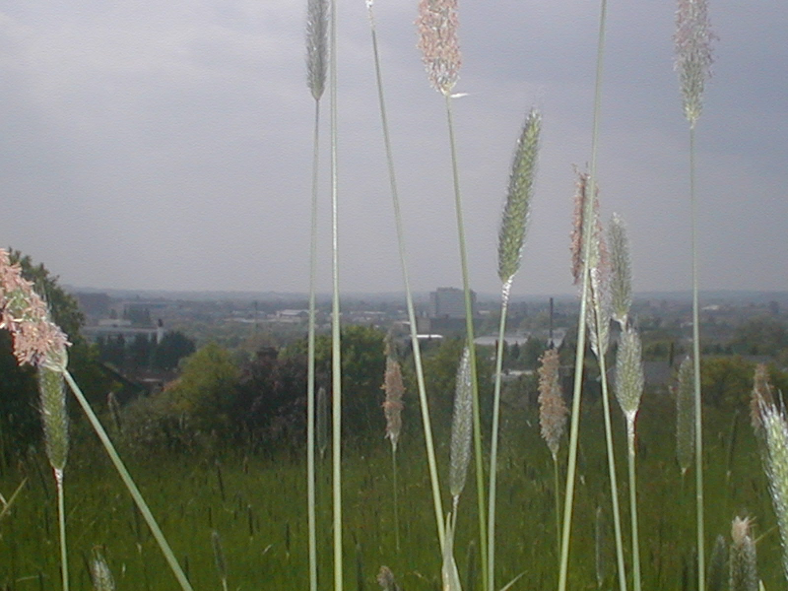
The view towards the Welsh Harp, meeting point of two rivers.
Beyond is Harrow on the Hill
A long footpath runs between Edgware and Burnt Oak alongside the Silkstream and the electric railway. The 1935 6-inch-to-one-mile OS map (Middlesex sheet XI.I.) shows a small feed stream running beneath the railway and footpath and into the Silkstream from the west, from the area of a sports ground. The stream is still there today, visible as a sparkling blackness just opposite where one of the new benches has been placed along the footpath’s length.
Spotting this by chance just recently, when I sat down to have a fag, I traced back up the footpath north, to Deansbrook Road (noting on the way that the chimmney by the Croft has gone) and turned right towards a low-point in the surface ahead. I turned right again into that new estate there, the one with streets named after famous cricketers. At the estate’s south end, where trident pales separate it from another recent development I turned down into the green space at the back of the flats. I was now, by my estimate, directly opposite where I’d seen the stream earlier on the other side of the railway tracks. And there it was, black and sparkly, running out from below a cement-based manhole cover. The water was speckled with fragments of white blossom and disappeared into some vaguely discernible culvert under the railway.

The "Railway" Stream surfaces adjacent to the Northern Line
Where the rill rises I have no idea. There was a suggestion of low ground running straight along the boundary between the two estates, beneath the base of the palings (this is what I call a run), but also another run alongside the railway all the way from Deansbrooks Road to the flats where I saw the brook surface.
Intent on getting to the bottom of this I returned to Deansbrook Road and crossed over (at the roads lowest point thereabouts, remember). Across the way, just west of where Wenlock Road leads off from Deansbrook Road, there is a grassy patch leading through to some new houses. I noted what looked like a dry river course in the grass, curving left towards where the railway cut under the road. There were a few small willows standing there and further on a mass of blackthorn. I rummaged around in the thorns and found a tiny little stream cutting through the undergrowth. It was a thing of rare beauty and I was very pleased to find it and to have my theories verified, my facility demonstrated in this way. I suspect the spring joins the Deansbrook nearby, somewhere by the railway line.
As always I am at a loss to name these little watercourses so I call the first the Railway Stream and the second the Wenlock Brook (though “brook” is perhaps too grand a title for such a diminutive thing!)

The tiny Wenlock Brook found beneath the Deansbrook Road
I lived alongside the Silkstream for a while back in 1971. My family were staying in the Croft, East Road, a homeless families’ hostel run by London Borough of Barnet. East Road at that time was home to a set of derelict factories – now replaced by characterless orange maisonettes – which seemed to catch fire one by one.
The Silkstream ran through burr-fields and ravings of elders and brambles – big black blobs in the late winter – and was inevitably the focus for young members of the Burnt Oak Bootboys. I smoked my first fag down by a rope-swing dangling over a curve in the stream, had my first fumbles with a girl named Maureen Mulling. Timmy Driscoll – later to live at Manor cottages by the A406 in East Finchley – gave me a tasty black eye for…for nothing in fact.

The Silkstream close by Colindeep Lane
Now I walk along this length of the river and much has changed: the tall chimmney that stood at the edge of the General Hospital’s grounds, for instance. The Croft is still there though I am no longer certain which window led through to the small white-painted bedroom I had. My dad and brother are dead, as are many of the Burnt Oak Bootboys; heroin took them in the 1980s. And Maureen? God knows. Those moments we had, of fear or joy, the plimsolls we wore by the mad stream, the two-tone tonics and Harringtons, the Fabs licked and sucked, the fags in long grass – they all rose to eternity, spiralling up into the Middlesex Sky to be stored in some vat of regional consciousness located beyond the Brockley Hills, the distant pylon-plateau of yearning.
It tears the heart, this inability to capture a place, a moment, maybe and store it in one of my old Kilner jars, rendering it retrievable in some more substantial form than mere memory and word. For I would present it to you and you would accept it with the love intended. And together we would walk into this landscape once again, restored to youth and hope.

The Silkstream enters the tunnel beneath Watling Avenue
Both the Burnt Oak Brook and the Silkstream flow through the Watling Estate, one of the old London County Council cottage estates built in the late 1920s to absorb population overspill resulting from slum clearance in the East End. I recall Watling back in the 1970s, the mixture of toughness and pride, the close-nit family networks, the criminality and decency intermingled. There were Hopcrofts’ and Burshalls’; a girl named Wendy Tapping everybody fancied; a mythic character a few years older than us named Stephan Werth who was reckoned to be well-hard.
The Silkstream runs under Watling Avenue via a tunnel mouth situated below backs of shops and adjacent to the Watling Market. There is something forbidding about this gaping maw of the tunnel, topped by an oxide-coated steel beam. The stream runs beneath the lives, below the stridency of this synthetic town with its pigeon fanciers, given over these last twenty years to fat coffin-like cars and sealed windows. The stream flows into darkness for a mere moment, dreaming no doubt of Death’s mouldy tits. The stream passes into memories of the Watling estate but these are nothing more than the dream of a mushroom god, having their moment and then gone!
I recall back in about 1971 looking down the stairwell leading from street level to the area designated for use as a market. Dozens of young men – aged about 13 to 15 – were bouncing up and down on the curved sheet-metal roofs of the market stalls, throwing pieces of tubing at each other. One of them lit a cigarette and glared at me, turning to speak to a pal who looked my way too. I didn’t recognise any of them as from my school, Goldbeaters, and feared they were Orange Hill Boys. I made myself scarce, preferring to get home by ascending Watling Street to Burnt Oak Broadway, walking past the cinema and the Wimpy Bar and down North Road.
The market was born of local belligerency: an article in the Hendon Times from boxing day 1930 and headed ‘A Watling “Riot”’ tells of how the Edgware police were pelted by a hostile crowd after attempting to close down an illegal market stall. Poor sub-divisional inspector Paice attempted to enforce a court order forbidding the busy pavement trading that was forcing the people of Burnt Oak to walk in the road. In particular he had it in for one Edwin John Powell, 24, 0f 80 Littlefield Road and Henry Thomas Whytock, 21, of 175 Pembroke Place, Edgware. Paice ordered Powell and Whytock to move their stalls whereupon Powell answered “I am only trying to make a living. Do you want me to go on the dole.” Paice ordered his colleague, Sergeant Clarke to take matters into hand and Powell kicked the good sergeant in the leg. Whytock then punched Paice “hard enough to daze him” and the crowd, reported as 400 strong, pelted the police with apples, oranges and onions.
The whole problem arose from the fact that the Watling Estate was badly served by shops in the first few years of its existence. Locals had to go to Edgware or Colindale to buy supplies and the coster-barrows were merely filling a local gap in the market, providing a service to the displaced Londoners relocated in Topham-Forrest’s LCC dream-town. It was in order to cover this need that an area was eventually dedicated as a market and continues to serve the local community down near the banks of the Silkstream.
It is worth noting here the many old trees dotting this remarkably beautiful estate, some of them relics of the area''s rural past.
On the far side of Watling Street the Silkstream is joined by the Burnt Oak Brook at a confluence tangled with tipped willows and ravings of summer bindweed. All through Silkstream Park the river is strewn with shopping trolleys and slime and then passes into Montrose Sports Field.

The brimbling brook running through bucolic Silkstream Park
A report in The Times dated December 13th 1922 stated that the Silkstream would have to be diverted to accommodate the new tube railway linking Hendon with Colindale, Burnt Oak (Watling) and Edgware. It was anticipated that 12000 tons of soil would be removed in this work. A stream feeds the Silkstream on the Montrose playing fields close by the old tram shed that served the Hendon Aerodrome railway, with a second feeder having its confluence directly opposite, by Merit House on the A5, this latter rising in Kingsbury. These two streams have been described collectively as the Tramway Ditch.An aerial photograph taken in 1922 and included in David Sullivan’s book, The Westminster Corridor (Historical Publications, 1994) shows extensive flooding of the Silkstream on either side of Watling Street. Following this the land was channelled between concrete embankments. At one point a canal company managed this stretch of the river! It is worth noting here that Mr Sullivan''s book contains a map ("Map N") that indicates the brook I call the Chalfont Brook formed part of the boundary between the pre-Norman "tracts" of Lotheresleage and Heandune.
Looking across the valley of the Silkstream
from Sunnyhill Park