
Slowly, and with a growing intensity, I became aware of the trunk water main running through my region. It started with intrigue; a sense of the oddly-manifest-and-yet-unexplained when I studied the long green avenue fenced off behind houses abutting onto Corringham Road in the Hampstead Garden Suburb. There were also the curious railed-in metal plates, set in concrete cradles glimpsed behind hedges in Golders Green; a reservoir perched at the high top of a suburban street; octagonal gateposts receding through successive segments of a band of secondary woodland purposely not built on.
It seemed that interspersed amidst the banalities, the parked cars and the shopping rush, there lurked the features of some other world; a silent, unnoticed set of zones, suggestions, rumours almost. I brooded on this and eventually, during one of those manic all-night map-reading sessions I suffer from, I realised that many of the gathered cardinal points of this strangely purposive set of landscape elements were actually running in a dead-straight line across the landscape. It was as if I had uncovered the evidence of a buried civilisation, of a race of (engineering) giants who’d left these indications of their endeavour on the surface of our world – traces so vast we’d had to accommodate our lives around them, rendering them no longer visible to us.
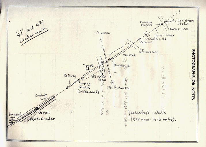
Sketch map of the Metropolitan
Waterboard watermain drawn by the author.
I resolved to explore this odd atemporal region, this spinal-chord of functional authority cutting purposively across endless futile car-journeys, cigarettes smoked, days forgotten. Sneaking out one day I followed the line drawn on my map, connecting the categories of key points, the manholes, green avenues and other indicators eastwards through the Garden Suburb.
I decided to start at the cutious pumping house set in a carpark opposite the Golders Green underground station on the Finchley Road.
The 1915 Ordnance Survey map of the area shows a straight line of posts running from Golders Green station towards and across the lands that would later become the Heath Extension. Looking at the lay of the land now UI saw these posts corresponded with a swathe of curiously unacknowledged green corridors running behind the houses of Rotherwick Road and either side of Corringham Road.
 Stand here, at this intersection of car and water and you can look off down the receding parallels of green towards their meeting beyond space and time. Or so I like to imagine at such times, as the conditioned city takes on a layered depth and speaks of new possibilities.
The Way (or the Old Way, as I also like to call it) carries on across the Heath Extension. Here it is visible in steel plates and elongated humps of earth topped by young sessile oaks and hawthorn It is then traceable down alongside Kingsley Way, visible on the right-hand side adjacent to a line of trees by the roadside in still further plates and manholes. The green corridor re-emerges, with its familiar octagonal gateposts and spearhead fencing pointing the way ahead, woven into garden fabric at the road’s end. An old man I met recently told me these dedicated channels served during the war as a fast route from the Garden Suburb to the air raid shelters on the Heath Extension.

The watermain runs across the Heath Extension
The Way remains visible in a dead straight alignment of narrow gardens as it cuts across successive streets: Spencer Drive (where it runs up the side of a play school); Holne Chase and on to Winnington Road. Here it must cross a buried tributary of the Mutton Brook on its way down from the Hampstead Bagshots. The Way takes the road at an angle jutting up alonside a vast house guarded by electric gates and hastate palings as forbidding as anything the builders of the Way ever managed to make.
I had to divert around Bishops Avenue and Alymer Way (the A1) to find suggestions of the Way once more, here in ivied edges to gardens, fenced and walled by spider-webby brickwork on opposite sides of Bancroft Avenue.
Again, I had to circle round, onto the Great North Road, before I could find the Way once more.

Dreamy indicators of the watermain''s course
cut through the Garden Suburb
Highgate Edge, a block of flats on the west side of the road has a clear passage running down its south side. I followed up here until I found another clear indicator of the presence of the Way: a key-shaped green metal plate inscribed “MWB”. These had been found periodically on my journey and had joined the octagonal gateposts etc as proofs of the Way’s presence.
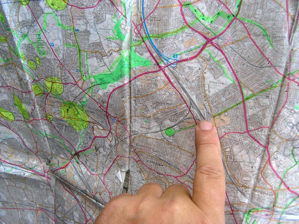
Across the A1000 another set of plates resting in a concrete frame alongside a garage pointed to a bridge carrying the underground railway over the Way. On the far side of the line, in Cherry Tree wood yet another fenced in set of plates carried the Way to the very margin of the Borough of Barnet. I traced the Way further but will leave this account for another day.
A few weeks later, dazzled and broken by what I had found, I took John Rogers of the Dersingham Hundred Psychogeography Group and the photographer Peter Knapp out to follow the route of the Way west from the Golders Green pumping station..
(It should be borne in mind here that over the interveaning time I had made enquiries. What had so drawn me and held my imagination was a 42- and 48 inch water main running through old Middlesex from Lea Bridge, on the Essex borders to Kempton Park in the far Southwest of the county.
 I have seen the Hidden Worlds! Hear me when I tell you that they brush up alongside us while we pursue our everyday. They are these straight tracks woven into the landscape, these secret courses cutting indifferently through our turmoil, our ridiculous complexity of street and life. They are these zones of peace murmuring softly right through our wars, our changing fashions. They were there the day we were born and will, most likely, persist long beyond our leaving.
One moment there is a bus or a dog, the tantrum scream of a sticky-faced child or a shaven-headed air of aggression. Then a glance over a fence at the back of a house off Woodstock Road brings on a receding of car alarm and trance music. It is the soft machinery of the city, this purposive band of green; a hidden route running for miles, up and down hills, through industrial estates, along grass verges between car lanes. This strip of timeless long-grassed near-meadow in an otherwise deeply laboured landscape of flats and shops, is a shock. It may even be the green fuse that drives the flowers.

An indicator of the watermain''s presence
Ahead it runs, a dignified sunlit residue of something felt rather than understood. And marking its way are green, padlocked gates and fences topped with spearheads. The gates are mounted on those curious iron posts one frequently finds in public parks or waterworks, with a bulbous top narrowing to an octagonal cylinder. Curiously ubiquitous yet invisible, historic and timeless in one, they have the air of groping towards a design for technology yet still encumbered by Victorian complication, by a desire to look nice.
It is the Old Way, this water main we intend to follow. Pull on your walking boots, load up with a flask of whiskey and sandwiches of pressed beef and off we go.
From Golders Green cross Finchley Road to the pumping shed in the forecourt of the mini-cab firm. Note the little 1930s huts used by the company for its offices. Their steel-frame Crittall windows postdate the technology of the Old Way. Though often seen as the harbinger of the modern, all this 1930s angularity and sleek plainness is undercut by the less recognisably Modern of the Old Way with its temerity of styling, its unwillingness to totally let go of Nature as a model.
Cross Golders Green Road now and make for the brightly coloured flower stall straight-ahead. An arch of privet hedge leading through to the Way frames the flowers on their barrow. Here is the floral gateway to our walk, the inane brushing up against the Immortal.
At the end of Accommodation Road, the cobbled street running behind the shops along Golders Green Road, a rotting fence brown with ineffective creosote partly hides one of our gateposts. The paint peels on the post and a tangle of saplings tangle up behind, a secret wild garden, home to rats and wrens.
Across Woodstock Road the Old Way cuts through the bottom of a garden where there is a thickening of sycamore. Glancing along here I see water seeping up through the soil and watery vegetation, all in a wedge across to the fence yonder and in direct alignment with a shed behind the houses of the next street.
The watermain is visible on the map as a
straight highlighted line.
If I walk to the end of Woodstock road and along to this next street, I can see what lies beyond the aforementioned shed, projecting a line straight-ahead. Either side of this road – The Ridgeway, there is a notable gap in the otherwise solid line of houses. Up one of these I can see the shed with the fenced course beyond. Across the road there are more old iron fences and gates and gate-posts, once again running ahead into deep silence despite the loud beat music issuing from an open window mere yards away. The Way runs ahead magisterially, with seeming indifference to deed of land or logic of ownership, slicing on its way through the lives of the righteously sensible house owners.
Turning into the Vale we see a large platform wedged in the angle formed by that road and Vale Rise. Meadow buttercups poke up through the uncut grass, which surrounds steel plates crosshatched with grooves and inscribed “J. Blakeborough & Sons, Brighouse”. Looking west across the valley of the Brent, I see the tall brick chimney of the pumping house at Cricklewood. The land is high here and I see further out, towards the new Wembley with the tottering gyroscope of its arch in its ellipsis.

A clear indication we are still on the Old Way
Yet further out, I see the jet slab of the offices at Stonebridge and receding lights all the way to Ealing, to Hounslow. It is at this station of the Way that I finally grasp the depth and scope of the engineering project I am aligned with. Waters pumped up from the Thames via Cricklewood to provide for the expanding suburbs in the late 19th century. Pumped up and stored in reservoirs in Golders Green and Muswell Hill, reservoirs on golf courses, at high paces demarked from the surrounding villas by green iron pales or, more often nowadays, rust-proof tridents.
The Way runs dead straight down the hill and across the Watford Way. Here it follows the further course of the Vale, buried deep beneath the grass zone between the traffic lanes adjacent to the Golders Green estate. On the day I visit workmen are lowering timbers into the hole dug into the Way. I ask one of them what the Way actually is and he verifies that it is built to carry water, pumped up from Kempton Park, far off in the southwest of the County, via Cricklewood, to supply London and the Northern Heights of Hampstead and Highgate. Apparently the water can be pumped in either direction, which is why there is another pumping station on the opposite side of the Hampstead petit massif behind Dirt House woods.
I asked him when the watercourse was laid out. He reckoned about 1906. He did think, however, that the main had been modified substantially in the 1930s. I returned home thinking about this, wondering what the main could tell us if it had agency and awareness, what it would have seen in its time:
The Pennine Traders
Give you Greeting and apprise you of their existence! On the Golders Green Estate, Hendon Way, equidistant from Hendon Central, Golders Green Road and Cricklewood, they ply their various trades and offer you everything you may need at strictly competitive prices.
At No.2, “The Little Shop,” M. Freeman (Gladstone 4564), you will find a comprehensive range of Children’s Wear, Drapery and Dressmaking sundries, not forgetting the all-important spare Collar Stud.
At No.3, The Post Office, T.J. Scott (Gladstone 4772), you can have your accumulator charged, refill your Cigarette Case or Tobacco Pouch, satisfy your needs as to Confectionary, Stationary, Lyons Cakes and Ices.
At No.6, R. F. Coleman (Gladstone 6088), will guarantee an early delivery of your moring paper or other periodical, book you a seat on a Coach to Anywhere, or serve you with tobacco, cigarettes etc.
(Taken from The Borough that is Called Hendon, published by the United Chambers of Commerce in the Borough of Hendon, 1935)
At the end of the Vale run a busy road and the railway to Northampton. Tucked in behind rust-proof tridents, amongst summer weeds, Teasals and Charlock, is the brick blockhouse. Set in concrete cradle, the blockhouse has been passed many times and yet always remained unnoticed. As turbo-charged diesels and morning sprinters ruffle the trackside flora on their endless runs and the waste-train clanks at dusk ready to journey to Bedfordshire, the Immutable Sage has remained. It is the temple of the Way, its omphalos a still point in the turning world.
(The Old Way carries on over into the Borough of Brent shortly after. This section will be covered in the near future.